James Spann: Flood threat continues; strong storms possible over west Alabama
SOAKED: Widespread rain continues across north and central Alabama this afternoon; we have a few embedded thunderstorms as well. Here are some rain totals as of 3 p.m. from the ABC 33/40 Skywatchers:
- Rock Creek — 2.54 inches
- Mountain Brook — 2.48
- Crestwood — 1.82
- Heflin — 1.62
- Northport — 1.24
A flood watch remains in effect for the part of Alabama along and north of I-59, but no doubt we could see some flooding a little to the south of that zone as well, across the central part of the state. Additional rain amounts of 1-3 inches are likely over the next 24 hours. The ground is saturated, and it won’t take much more rain for flooding to begin.
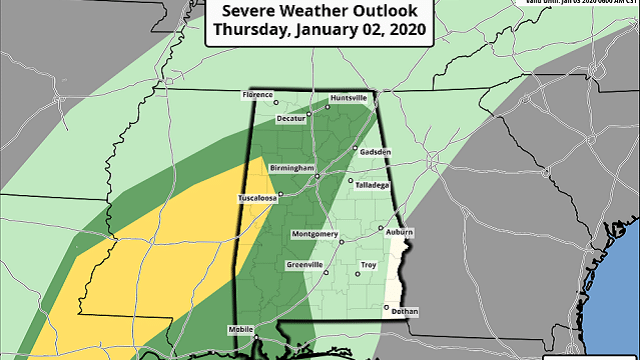
Also, the Storm Prediction Center has a slight risk (level 2 out of 5) of severe thunderstorms defined for a part of west Alabama, with a marginal risk (level 1 of 5) for the rest of north and central Alabama through tonight.
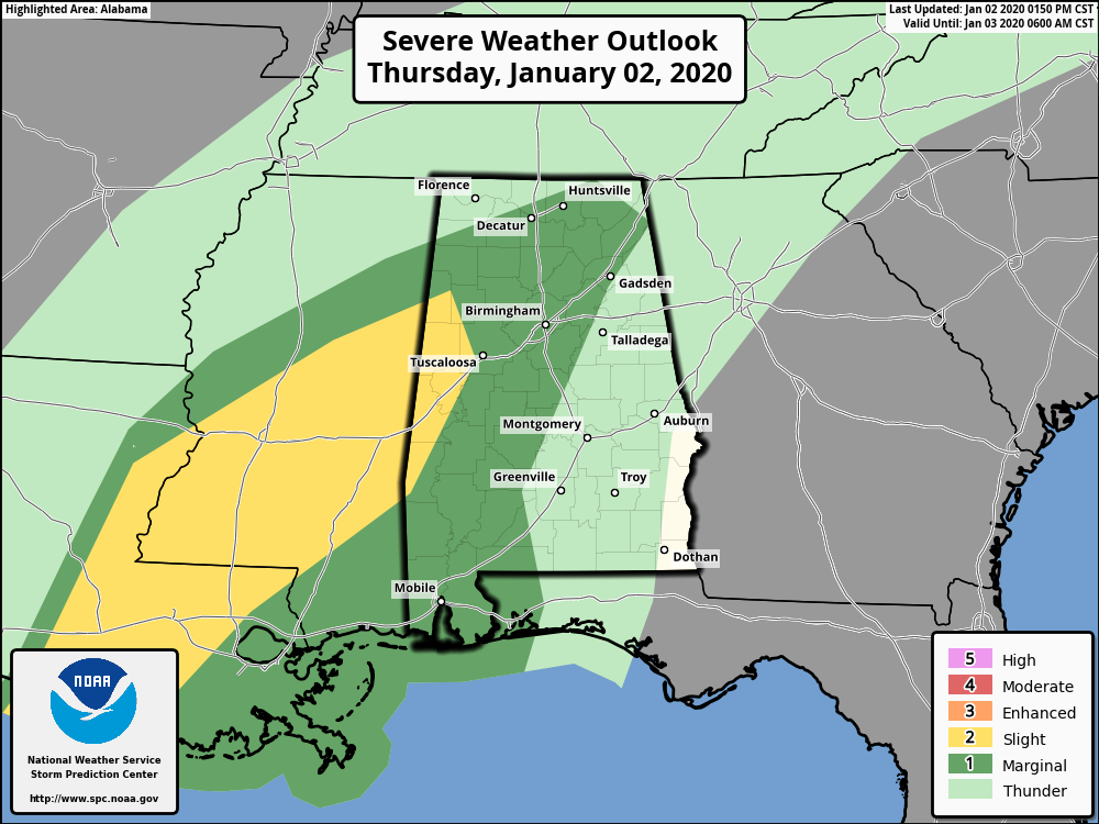
Warmer, unstable air over south Alabama is trying to move northward (Mobile and Dothan are in the low 70s), and the increasing instability means some risk of strong storms over the western side of the state tonight. The main threat will come from strong, gusty winds, but an isolated tornado can’t be ruled out near the Mississippi border.
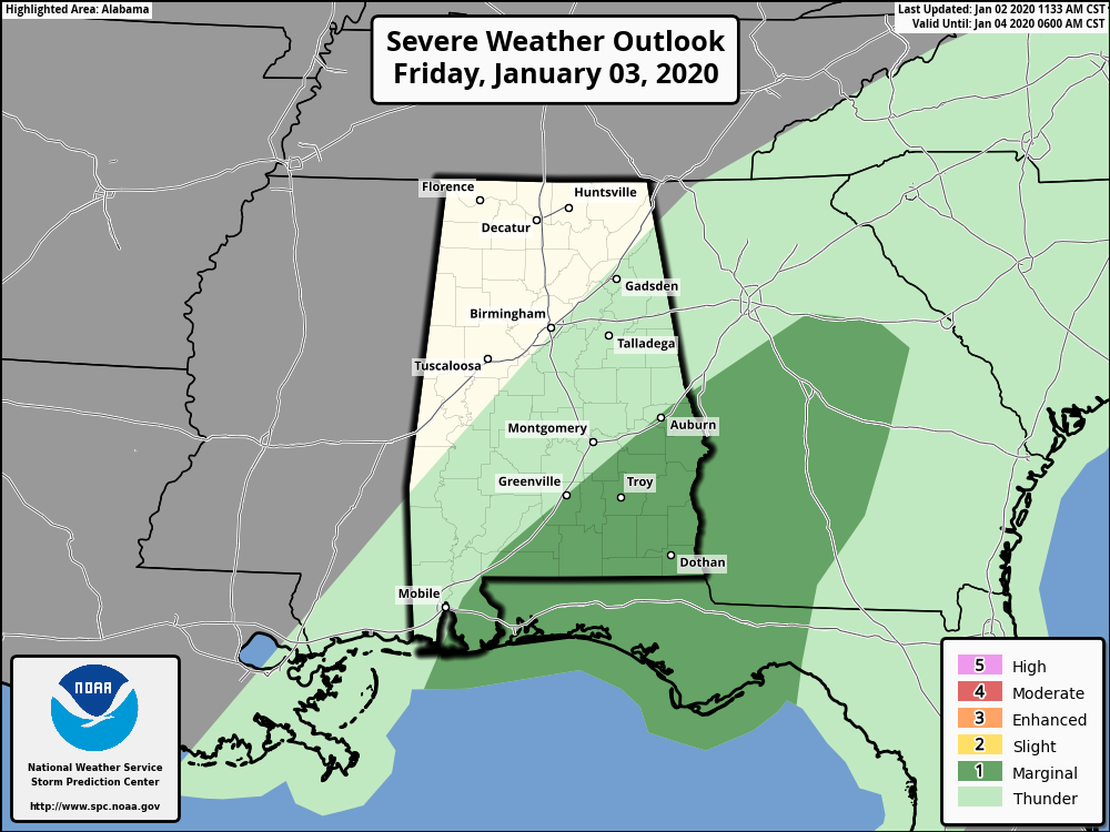
Occasional rain will continue Friday across the state. There is a marginal risk of severe storms south of a line from Daphne to Greenville to Auburn.
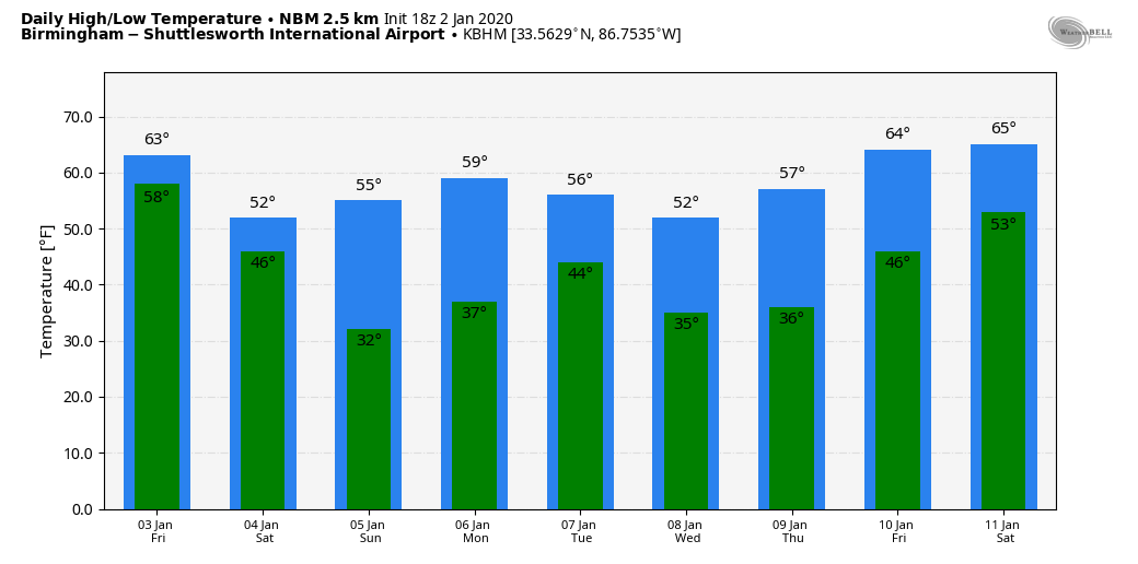
THE ALABAMA WEEKEND: Some lingering light rain is possible Saturday morning; otherwise the day will be windy and colder, with a high around 50 degrees. Some clearing is possible by afternoon. A cold-core upper low will pass just north of Alabama, and it could bring a few snowflakes to parts of Tennessee and Kentucky. Sunday will feature a good supply of sunshine; we start the day in the 28- to 32-degree range, followed by a high in the mid 50s.
NEXT WEEK: The next chance of rain will come late Monday night into Tuesday; rain amounts with this feature should be fairly light. Then, another rain event is shaping up around Friday or Saturday, Jan. 10-11.
ON THIS DATE IN 1955: Hurricane Alice passed through the Islands of Saint Martin and Saba in the Caribbean Sea. Alice, which developed on Dec. 30, 1954, is the only known Atlantic hurricane to span two calendar years.
BEACH FORECAST: Click here to see the AlabamaWx Beach Forecast Center page.
WEATHER BRAINS: You can listen to our weekly 90-minute show any time on your favorite podcast app. This is the show all about weather featuring many familiar voices, including the meteorologists at ABC 33/40.
CONNECT: You can find me on the major social networks:
Facebook
Twitter
Instagram
Pinterest
Snapchat: spannwx
For more weather news and information from James Spann and his team, visit AlabamaWx.


