PDS tornado watch In effect for much of Central Alabama until 11 p.m.

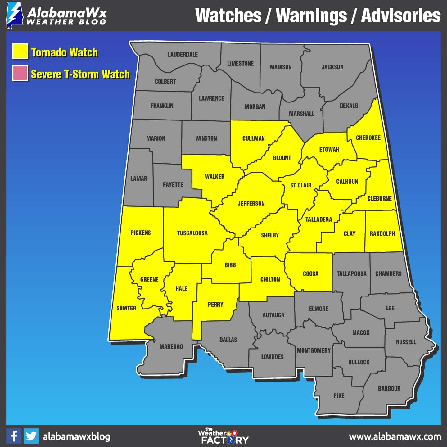 The National Weather Service Storm Prediction Center has issued a tornado watch for portions of Central Alabama effective until 11 p.m.
Counties that remain under a tornado watch Bibb, Blount, Calhoun, Cherokee, Chilton, Clay, Cleburne, Coosa, Cullman, Etowah, Greene, Hale, Jefferson, Perry, Pickens, Randolph, Shelby, St. Clair, Sumter, Talladega, Tuscaloosa and Walker.
This is a Particularly Dangerous Situation (PDS), the NWS has declared.
Primary threats include:
Several tornadoes and a few intense tornadoes likely
Scattered large hail and isolated very large hail events to 3 inches in diameter likely
Scattered damaging wind gusts to 70 mph possible
Several severe storms will develop along a cold front through tonight producing strong tornadoes, very large hail, and damaging winds.
A tornado watch means conditions are favorable for tornadoes and severe thunderstorms in and close to the watch area. Persons in these areas should be on the lookout for threatening weather conditions and listen for later statements and possible warnings.
For more weather news and information from Scott Martin and the rest of the James Spann team, visit Alabama Wx.


