On this day in Alabama history: Alabama accepted Georgia boundary

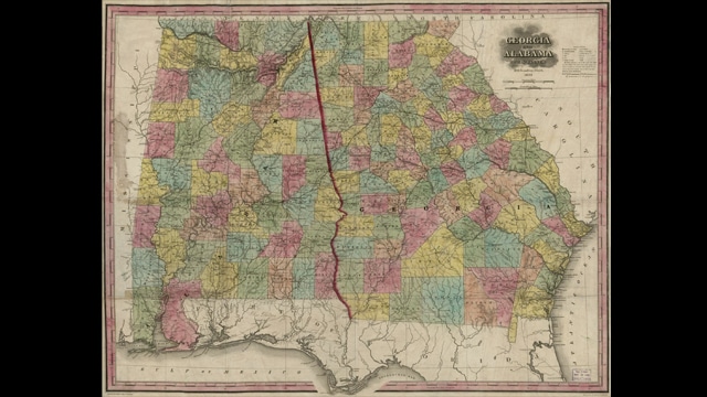
Map of Alabama and Georgia, 1853. (Henry Schenck Tanner, Library of Congress, Geography and Map Division)
January 27, 1840
It had been a bone of contention, off and on, since the founding of the state. But on this day, the Alabama Legislature finally passed a joint resolution, accepting the disputed boundary line with Georgia. Alabama was created in 1819 from a portion of land originally ceded by Georgia to the federal government in 1802. The 1802 agreement stipulated the western boundary of Georgia as the western bank of the Chattahoochee River from the Florida line to Miller’s Bend (present-day West Point, Georgia) and then northward in a straight line to Nickajack, near present-day Chattanooga, Tennessee. After Alabama became a state, Georgia officials requested that a joint survey be conducted to firmly establish the boundary, but Alabama abandoned its share of the project, leaving Georgia to complete the survey on its own in 1826. Alabama officials disagreed with some elements in the Georgia survey, but ultimately decided in 1840 to accept the results. “A fixed and known line between this State and Georgia, is of far higher consequence to us, than the acquisition of an inconsiderable portion of territory,” the Legislature said.
Read more at Encyclopedia of Alabama or Georgia’s Virtual Library.


For more on Alabama’s Bicentennial, visit Alabama 200.


