James Spann: Showers, storms return to Alabama Thursday afternoon
James Spann has the midweek forecast for Alabama from Alabama NewsCenter on Vimeo.
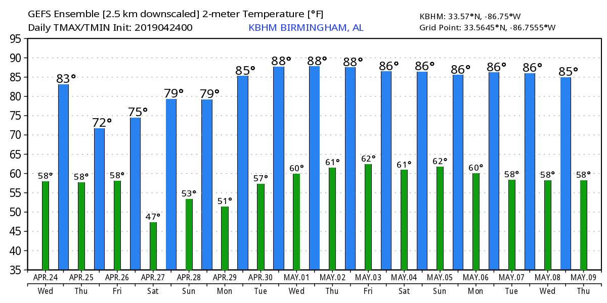
ONE MORE WARM, DRY DAY: Not much change in the Alabama weather situation today. We expect a good supply of sunshine with a high in the low to mid 80s this afternoon. The average high for April 24 in Birmingham is 76.
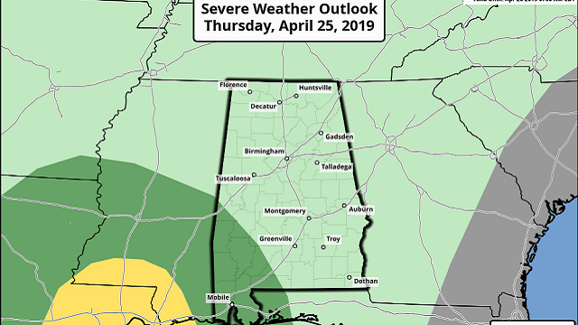
THURSDAY/FRIDAY: Clouds increase across Alabama Thursday, and showers and storms could enter the western part of the state during the afternoon. A few showers and thunderstorms are likely Thursday night statewide; the Storm Prediction Center maintains a marginal risk (level 1 of 5) for southwest Alabama.
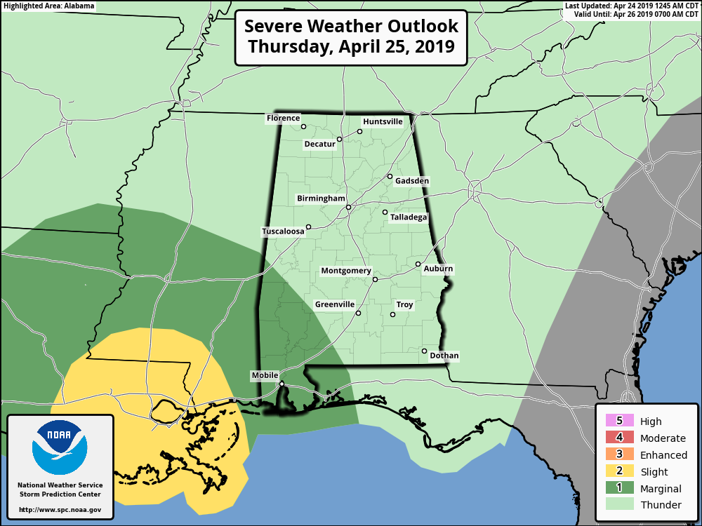
Severe storms are not expected over the northern half of the state, and for most places rain amounts should be around one-half inch. The main window for showers will come from around 4 p.m. Thursday through 4 a.m. Friday.
The sky becomes partly to mostly sunny Friday as dry air returns to the state. The high will be in the upper 70s Thursday, followed by mid 70s Friday.
THE ALABAMA WEEKEND: Saturday will be mostly sunny with a warm afternoon; the high will be close to 80 degrees. Then, on Sunday, a weak surface front will slip into the state, but the air still looks too dry to mention any meaningful chance of rain. With a mix of sun and clouds, the high Sunday will be in the mid to upper 70s.
RACE WEEKEND AT TALLADEGA: After a round of showers Thursday night, the weather looks excellent Friday through the weekend, becoming partly to mostly sunny Friday with a high in the mid 70s. Saturday will be sunny with a high near 80, and on Sunday we expect mixed sun and clouds with afternoon temperatures in the 70s.
NEXT WEEK: An upper ridge will bring the warmest weather so far this year to the state. Afternoon temperatures will rise into the mid to upper 80s on most days. Dry weather is expected through Thursday; a few showers could ease into the state on Friday.
ON THIS DATE IN 1908: The “Dixie Outbreak.” At least 34 tornadoes touched down generally east of the Mississippi River from April 23 through April 26, 1908. These tornadoes generally occurred from Texas to Georgia, then northward from Oklahoma to Tennessee. The violent storms killed at least 320 people and injured more than a thousand. One of the hardest-hit communities was Purvis, Mississippi, where the town was completely leveled and 55 people lost their lives. At least four tornadoes touched down in Alabama during this outbreak. These tornadoes were responsible for approximately 48 fatalities and at least 260 injuries. An EF-4 moved from Walker County to Dekalb County in north Alabama, and was responsible for 35 deaths.
BEACH FORECAST: Click here to see the AlabamaWx Beach Forecast Center page.
WEATHER BRAINS: You can listen to our weekly 90-minute show any time on your favorite podcast app. This is the show all about weather featuring many familiar voices, including the meteorologists at ABC 33/40.
CONNECT: You can find me on all of the major social networks:
Facebook
Twitter
Instagram
Pinterest
Snapchat: spannwx
For more weather news and information from James Spann and his team, visit AlabamaWx.


