Scott Martin: Fantastic, mild holiday week for Alabama

WARMER-THAN-NORMAL CHRISTMAS: While it won’t be as warm as it was on Christmas Eve, we are still expecting temperatures to remain well above normal for late December in Alabama. We’ll have a few more clouds floating overhead, but we should still stay mostly clear. Highs will drop back into the mid to upper 60s.
DRY THROUGH THE WORK WEEK: The good news is that we can remove the rain chances from the forecast for Thursday and Friday, but skies become mostly cloudy Thursday and remain that way through Friday. Highs on both days will be in the mid-60s to the lower 70s.
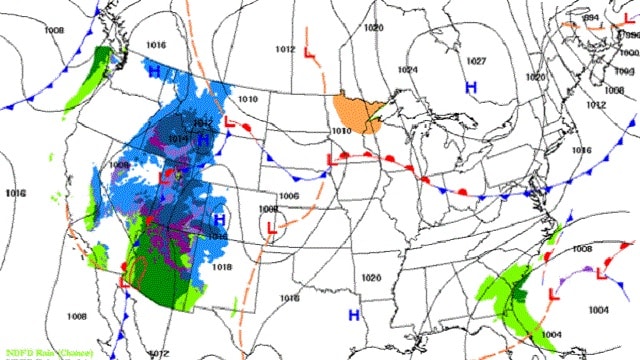
THE ALABAMA WEEKEND: A surface low will start the day Saturday over east-central Kansas and will move northeast through the day. A cold front will trail down into the Southeast from the low, bringing rain chances into the forecast for late Saturday through much of the day Sunday. Some thunder will be possible, as there will be some instability ahead of the cold front during the pre-dawn and early morning Sunday, but at this point it is too far out to tell whether severe weather will be possible. Highs will be in the upper 60s to the lower 70s Saturday, dropping into the upper 50s to the lower 70s Sunday.
COLDER MONDAY: As we start into the transition week from 2019 to 2020, Monday looks to be a cooler day than we will see for the rest of this week. Showers may be pushing out of the state very early in the day, but clouds look to decrease throughout the day. Highs will be in the lower 50s to the lower 60s.
VOODOO LAND: After Monday, we look to stay dry through next week until we reach Friday, Jan. 3. A cold front is forecast to push through the area with showers and storms, but should quickly move out by midday Saturday, Jan. 4. This may and probably will change, as this is “Voodoo Land.”
ON THIS DAY IN 1988: Early morning thunderstorms developing along a cold front spawned a powerful tornado at Franklin, Tennessee, which killed one person, injured seven others and caused $8 million damage. Another in a series of winter storms in the western U.S. produced 20 inches of snow at Blue Canyon, California, in 24 hours. Bishop, California, received 14 inches of snow in just six hours and Redding, California, which averages 3 inches of snow per year, was blanketed with 10 inches.
BEACH FORECAST: Get the latest weather and rip current forecasts for the beaches from Bay St. Louis, Mississippi, to Panama City Beach, Florida, on our Beach Forecast Center page. There, you can select the forecast of the region you are interested in.
CONNECT: You can find us on the major social media networks:
Facebook
Twitter
Instagram
For more weather information from James Spann, Scott Martin and other members of the James Spann team, visit AlabamaWx.


