James Spann: Alabama stays dry through Friday; severe storms possible Sunday
James Spann forecasts a warm-up for Alabama today, more storms Sunday from Alabama NewsCenter on Vimeo.
ANOTHER COLD ONE: This should be the last significant threat of a freeze and frost for most of Alabama until October. Here are some temperatures just before daybreak:
- Black Creek — 29
- Oneonta — 29
- Fort Payne — 31
- Heflin — 31
- Gadsden — 32
- Hueytown — 32
- Weaver — 32
- Cullman — 33
- Bessemer — 33
- Haleyville — 34
- Grayson Valley — 34
- Anniston — 35
- Decatur — 35
- Pell City — 36
- Demopolis — 36
- Huntsville — 37
- Birmingham — 38
- Prattville — 38
- Tuscaloosa — 39
- Montgomery — 44
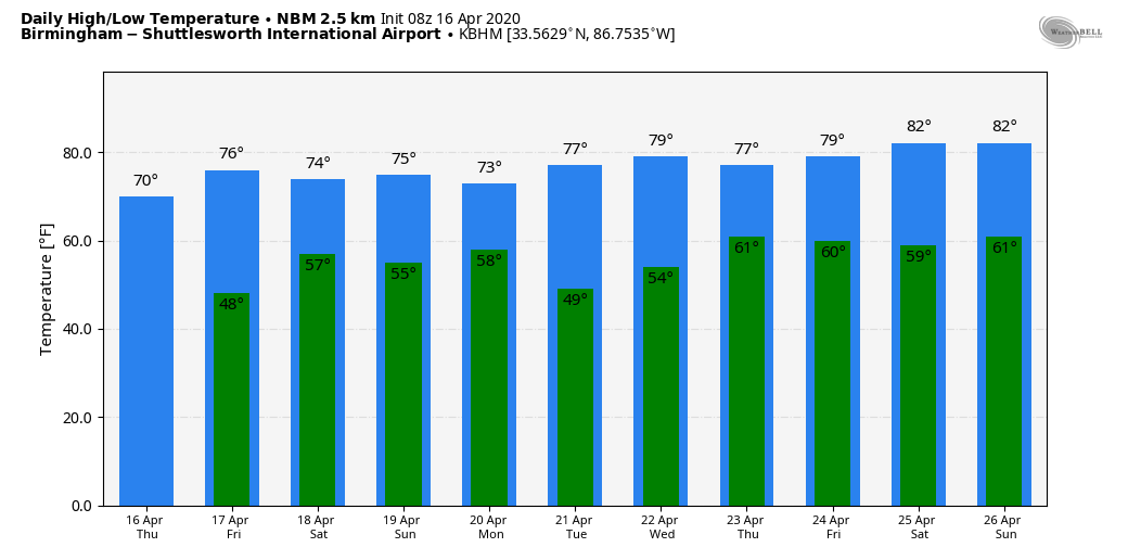
Look for a nice warm-up today; with ample sunshine we will enjoy a high around 70 degrees. Friday will be dry as well; the sky will be partly to mostly sunny with a high in the mid to upper 70s. Clouds will increase Friday night.
SATURDAY: A cold front will bring a band of showers into the northern half of the state very early Saturday morning. The best chance of rain comes from 3 until 8 a.m., and amounts should be one-quarter inch or less. The rest of the day Saturday will be dry with some afternoon sun and a high around 70 degrees.
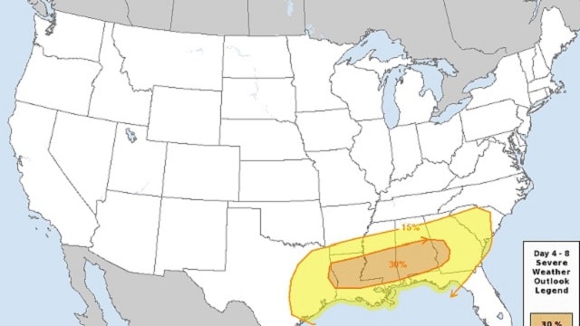
STRONG/SEVERE STORMS SUNDAY: Models have trended northward with the surface wave that is expected to move along the front, and the Storm Prediction Center has defined a severe weather risk for much of the state Sunday afternoon and Sunday night. An enhanced 30% area is over the southern half of the state.
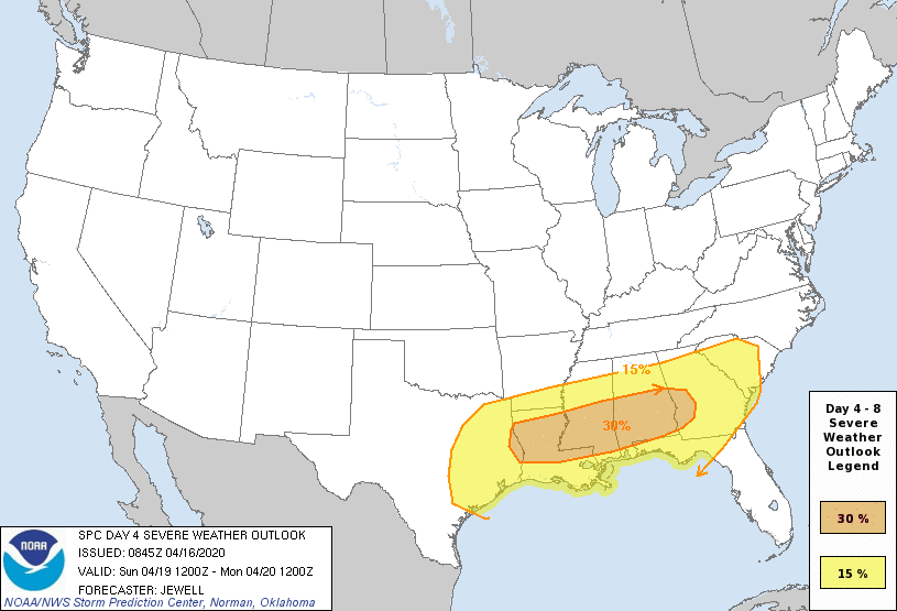
A surface low will move across Alabama Sunday evening; the exact track of the low will determine the greatest risk of severe storms. Areas south of I-20 will have potential for thunderstorms with large hail, damaging wind and a few tornadoes. The risk is a bit more conditional to the north, but severe storms are possible for north Alabama as well. For now it looks like the main window for severe weather comes from 3 p.m. Sunday until 3 a.m. Monday, and rain amounts will be 1-2 inches.
NEXT WEEK: Rain ends early Monday, followed by afternoon clearing. Tuesday will be dry and mild; then another significant system will bring the threat of strong, possibly severe thunderstorms back into Alabama at some point in the Wednesday/Thursday time frame. It’s way too early to be specific; just something to watch for now. Drier air returns at the end of the week.
ON THIS DATE IN 2008: Typhoon Neoguri formed over the South China Sea on April 15 and rapidly intensified to attain typhoon strength by April 16, reaching its peak intensity on April 18 with maximum sustained winds near 109 mph. More than 120,000 people were evacuated from Hainan when heavy rains caused flash floods in low-lying areas. Three fatalities were attributed to the storm, though 40 fishermen were reported missing. Neoguri made landfall in China earlier than any other tropical cyclone on record, about two weeks before the previous record set by Typhoon Wanda in 1971.
WEATHER BRAINS: You can listen to our weekly 90-minute show anytime on your favorite podcast app. This is the show all about weather featuring many familiar voices, including the meteorologists at ABC 33/40.
CONNECT: You can find me on all of the major social networks:
Facebook
Twitter
Instagram
Pinterest
Snapchat: spannwx
For more weather news and information from James Spann and his team, visit AlabamaWx.


