James Spann: A few strong storms possible near Alabama-Tennessee border
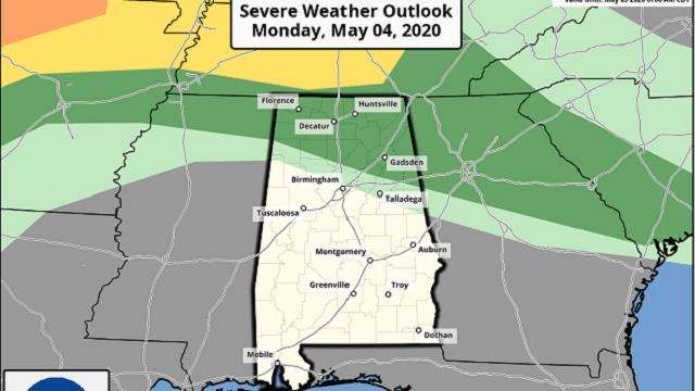
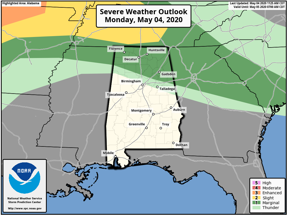
WARM, DRY DAY: Temperatures are mostly in the low to mid 80s across Alabama this afternoon with a mix of sun and clouds. We are watching strong to severe storms over northwest Arkansas; those will roll through Tennessee this evening with potential for damaging winds and some hail. Some of these storms could clip far north Alabama; the Storm Prediction Center maintains a marginal risk (level 1 out of 5) of severe storms for this possibility.
But at the moment it looks like the majority of the thunderstorms tonight will stay just north of Alabama. For most of the state the sky will be mostly fair tonight with a low in the 60s.
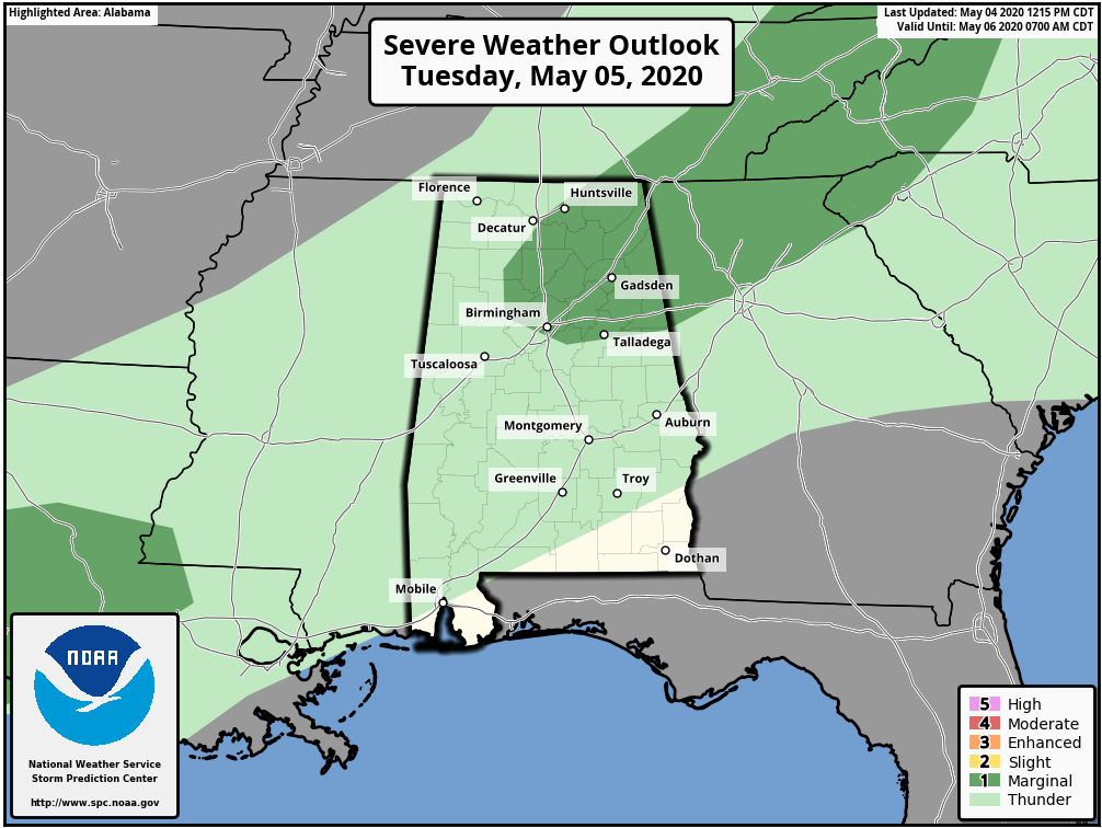
Warm weather continues Tuesday; we project a high in the low 80s with cloudy periods. A cold front will bring a band of showers and possibly a few thunderstorms into north Alabama late in the day and Tuesday night. A few of these storms could be strong; the SPC has a marginal risk (level 1 of 5) defined for the northeast counties for this front.
WEDNESDAY THROUGH FRIDAY: Much cooler air rolls into Alabama Wednesday; the high will be in the 65- to 70-degree range with a partly to mostly sunny sky. We drop down into the mid 40s early Thursday morning; colder pockets could see upper 30s over north Alabama. The day Thursday will be sunny with a high in the low 70s.
Clouds increase Thursday night, and another cold front will bring a few showers to the state Friday. Rain amounts will most likely be on the light side with a high close to 70 degrees.
THE ALABAMA WEEKEND: Unusually cool air for mid-May arrives Saturday. The sky will be sunny with a high in the mid to upper 60s; average temperatures here are in the low 80s for May 9-10. Sunday morning will be cold; most communities will see a low in the low 40s, but colder spots will drop into the 30s, and we will have to look at some very late-season frost across valleys and protected areas. Growers need to keep an eye on temperature forecasts. Sunday will be sunny with a high in the mid 70s.
NEXT WEEK: Dry and pleasant weather is the story for the beginning of the week, but global models suggest some chance of showers by Wednesday or Thursday. There’s still no sign of any major severe weather issues or excessive rain events for the next seven to 10 days.

ON THIS DATE IN 2007: A devastating EF5 twister demolishes nearly every structure in Greensburg, Kansas, around 9:30 p.m. and kills 10. The mammoth wedge tornado cuts a swath 1.7 miles wide and 22 miles long across the Kansas landscape. It is the worst single tornado to touch down in the U.S. in eight years.
BEACH FORECAST: Click here to see the AlabamaWx Beach Forecast Center page.
WEATHER BRAINS: You can listen to our weekly 90-minute show any time on your favorite podcast app. This is the show all about weather featuring many familiar voices, including the meteorologists at ABC 33/40.
CONNECT: You can find me on the major social networks:
Facebook
Twitter
Instagram
Pinterest
Snapchat: spannwx
For more weather news and information from James Spann and his team, visit AlabamaWx.


