James Spann: Snow, sleet approaching northwest Alabama
ANOTHER WINTER STORM: A Winter Storm Warning remains in effect for Lamar, Marion, Winston, Franklin, Colbert, Lauderdale, Lawrence and Limestone counties through tonight. A Winter Weather Advisory is in effect for Morgan, Madison, Jackson, Pickens, Fayette and Walker counties.
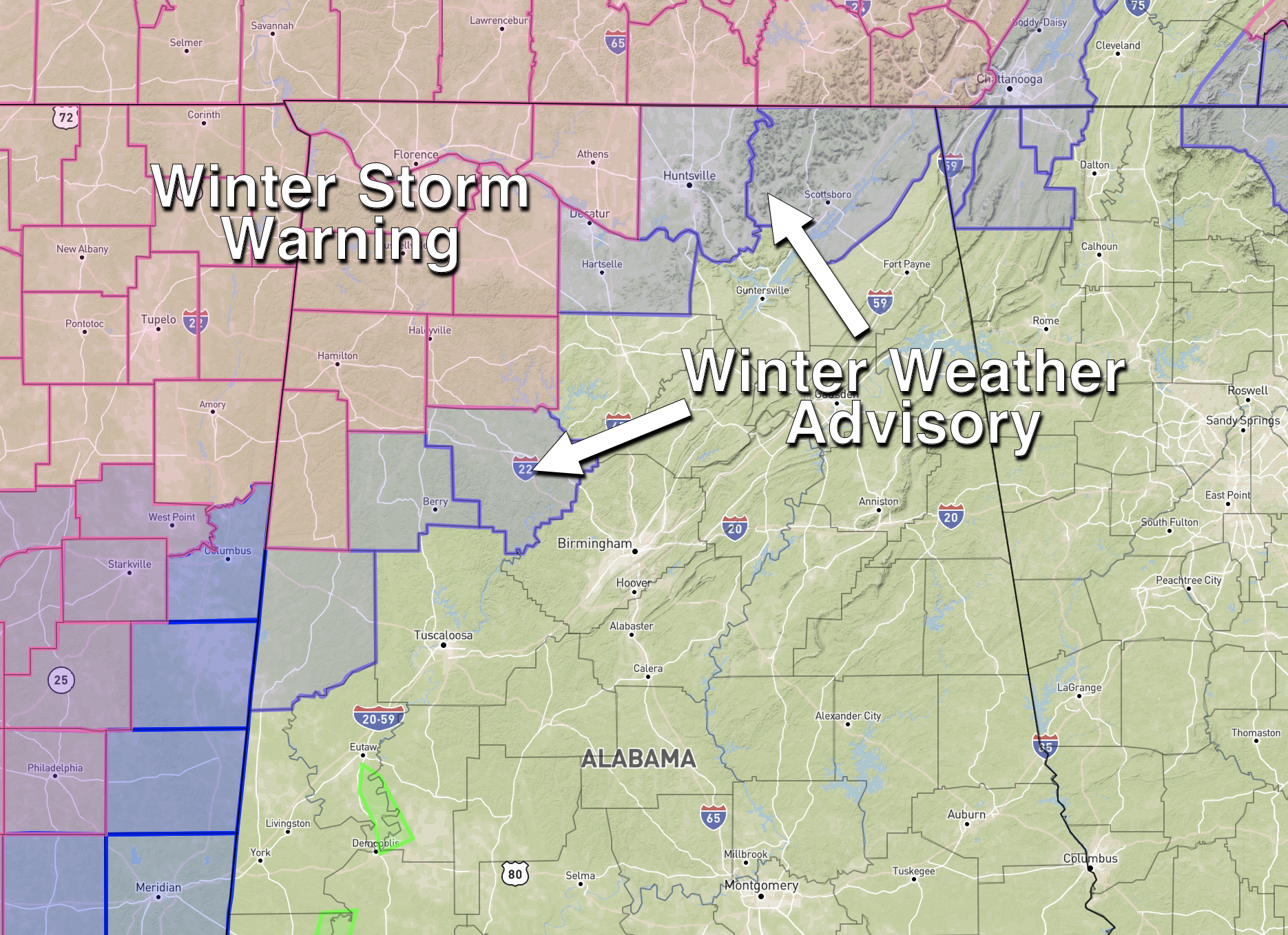
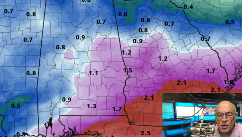
A large area of snow and sleet is moving into northwest Alabama and will continue tonight. Snow amounts could exceed 3 inches around Florence and Muscle Shoals; amounts of 1-2 inches are possible down to places like Hamilton and Haleyville. A wintry mix is possible across the Winter Weather Advisory area for a few hours, but precipitation there should change to rain later tonight as warmer air creeps northward.
Road conditions will deteriorate across the Winter Storm Warning area over the next few hours as snow and sleet increase in intensity.
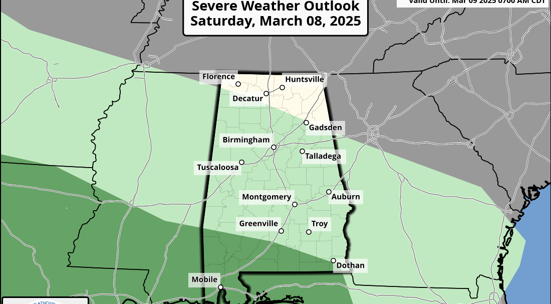
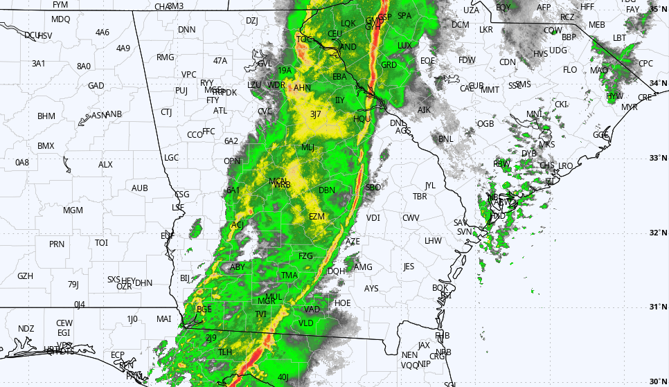
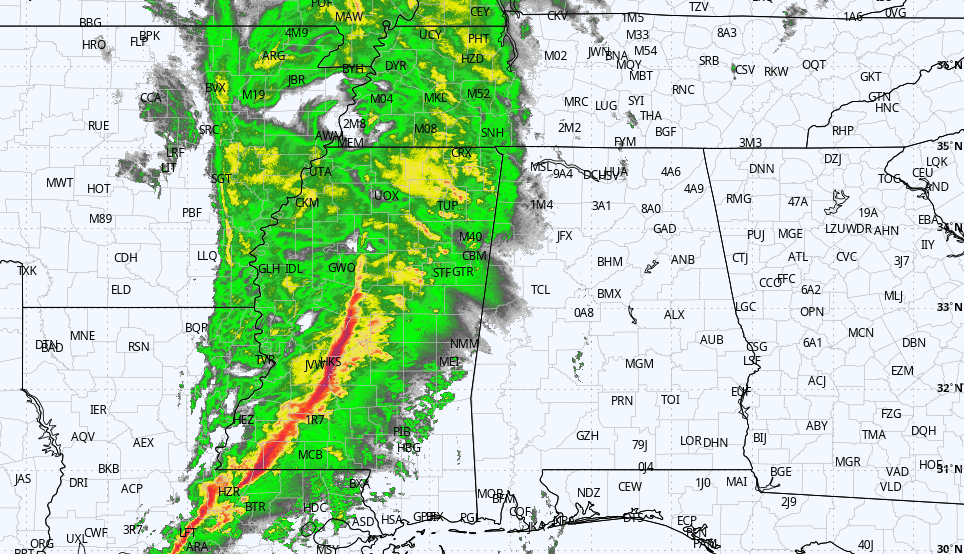
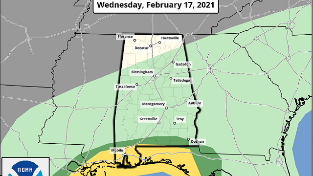
A cold, soaking rain is likely for places like Birmingham, Tuscaloosa, Anniston, Gadsden and Montgomery tonight. Rain amounts of 1-2 inches are likely. And for far south Alabama, severe thunderstorms could become an issue tonight. The Storm Prediction Center maintains a slight risk (level 2 of 5) for Mobile and Baldwin counties, with a marginal risk (level 1 of 5) up to U.S. 84. Storms over the southern part of the state tonight could produce hail and strong winds, and an isolated tornado or two is not out of the question.
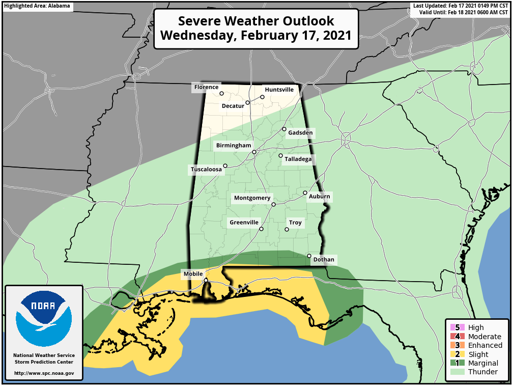
Severe storms remain possible Thursday morning over the southeast corner of Alabama, but the threat should be over there by noon.
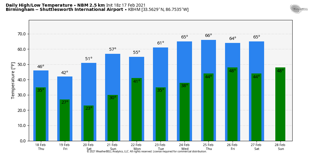
THURSDAY: The day will be cloudy and cold with scattered light rain or snow flurries. Temperatures will hold in the 30s over the northern third of the state, with 40s for central Alabama and 50s to the south. Flurries remain possible Thursday night as another shot of colder air moves in.
FRIDAY AND THE WEEKEND: Friday will be dry; the sky becomes partly sunny by afternoon. Temperatures will be similar to what we expect Thursday, about 15-20 degrees below average for mid-February in Alabama. With a clear sky, we project a low between 18 and 25 degrees Saturday morning. Then a warming trend begins as temperatures rise into the low 50s Saturday and low 60s Sunday with a good supply of sunshine both days.
NEXT WEEK: A Pacific cold front will bring a few showers Monday; the rest of the week looks dry and very pleasant, with highs generally in the 60s.
ON THIS DATE IN 1995: A pre-dawn F3 tornado tore through parts of Cullman and Marshall counties in north Alabama, killing five people in the communities of Joppa and Arab.
BEACH FORECAST: Click here to see the AlabamaWx Beach Forecast Center page.
WEATHER BRAINS: You can listen to our weekly 90-minute show anytime on your favorite podcast app. This is the show all about weather featuring many familiar voices, including the meteorologists at ABC 33/40.
CONNECT: You can find me on the major social networks:
For more weather news and information from James Spann and his team, visit AlabamaWx.