James Spann: Blistering summer heat for Alabama through Saturday
James Spann forecasts very hot, humid days for Alabama from Alabama News Center on Vimeo.
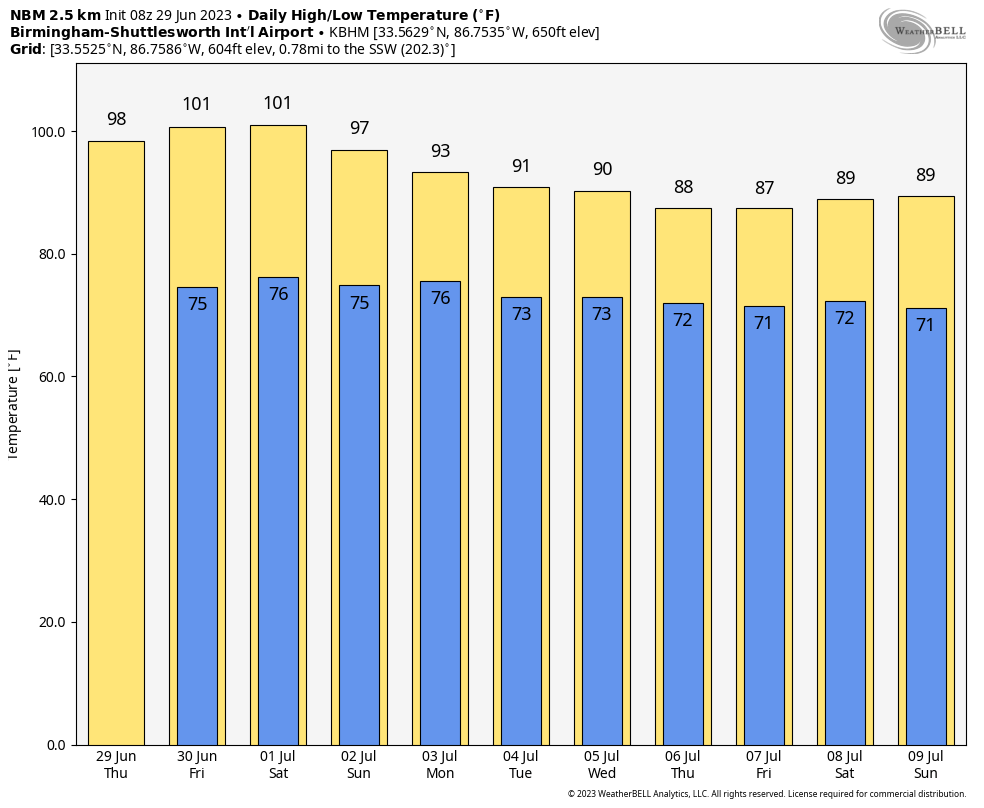
BLOW-TORCH HEAT: Summer heat will be the big weather story for Alabama and the Deep South through the weekend — easily the hottest weather so far this year. Expect a high between 95 and 100 degrees today and Friday, followed by mid 90s over the weekend. Factor in the high humidity, and the heat index will peak at 105-110 through Friday over the western two-thirds of the state, where an excessive heat warning is in effect. There is a heat advisory for east Alabama, where the heat index will rise into the 100- to 105-degree range.
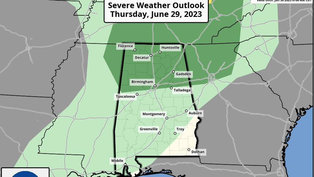
Most locations will be dry through Friday with lots of hazy sunshine, but the Storm Prediction Center has defined a marginal risk of severe thunderstorms for parts of north Alabama due to the potential for storms dropping down into the state from Tennessee from time to time. Usually the strong upper ridge will suppress any storms, but we will keep an eye on radar trends.
FOURTH OF JULY WEEKEND: The ridge slowly weakens, but the weather remains hot Saturday and Sunday, with highs between 94 and 98 degrees. The heat backs down Monday and Tuesday, with a high close to 90 degrees. Each day we will mention the chance of a few random, scattered afternoon and evening showers and thunderstorms; odds of any one spot getting wet each day are around 30%. Most of the storms will come from 2 until 9 p.m.
REST OF THE WEEK: Showers and storms will increase in coverage over the latter half of the week as moisture levels rise and the air becomes more unstable; highs drop into the upper 80s, which is below average for early July in Alabama.
 TROPICS: A surface trough is producing disorganized showers and thunderstorms a few hundred miles south-southeast of Bermuda. Upper-level winds are marginally conducive for some slow development of this system during the next few days while it moves generally northward at 5 to 10 mph. The National Hurricane Center gives it only a 20% chance of development.
The rest of the Atlantic basin, including the Gulf of Mexico, is very quiet and tropical storm formation is not expected through early next week.
ON THIS DATE IN 1998: “The Corn Belt Derecho of 1998” hit Nebraska, Iowa, Illinois, Indiana and Kentucky. A derecho that originated in far southeast South Dakota moved across Illinois during the afternoon and evening and continued as far east as Ohio the next morning. Every county in central Illinois sustained some damage as these severe thunderstorms passed. Winds gusted at 60 to 80 mph, with some localized microbursts producing winds of more than 100 mph. Significant damage occurred in the microburst areas, including the towns of Morton, McLean, LeRoy and Tolono.
For more weather news and information from James Spann and his team, visit AlabamaWx.


