James Spann: Dry weekend for Alabama before possible light rain, colder temps on Monday
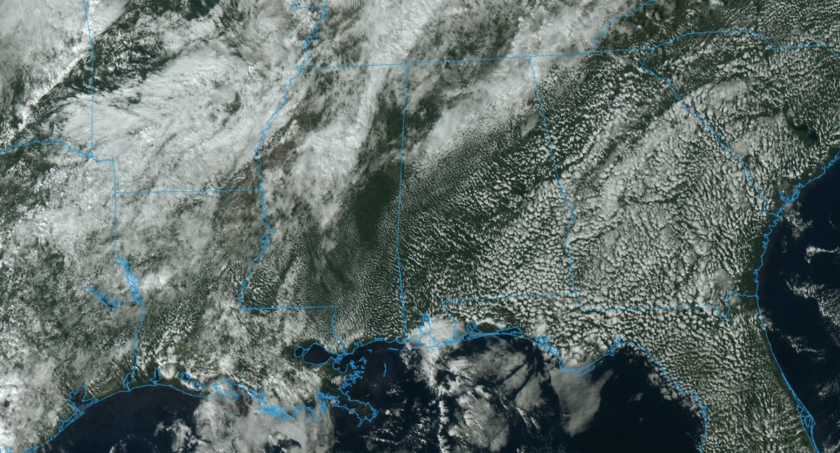
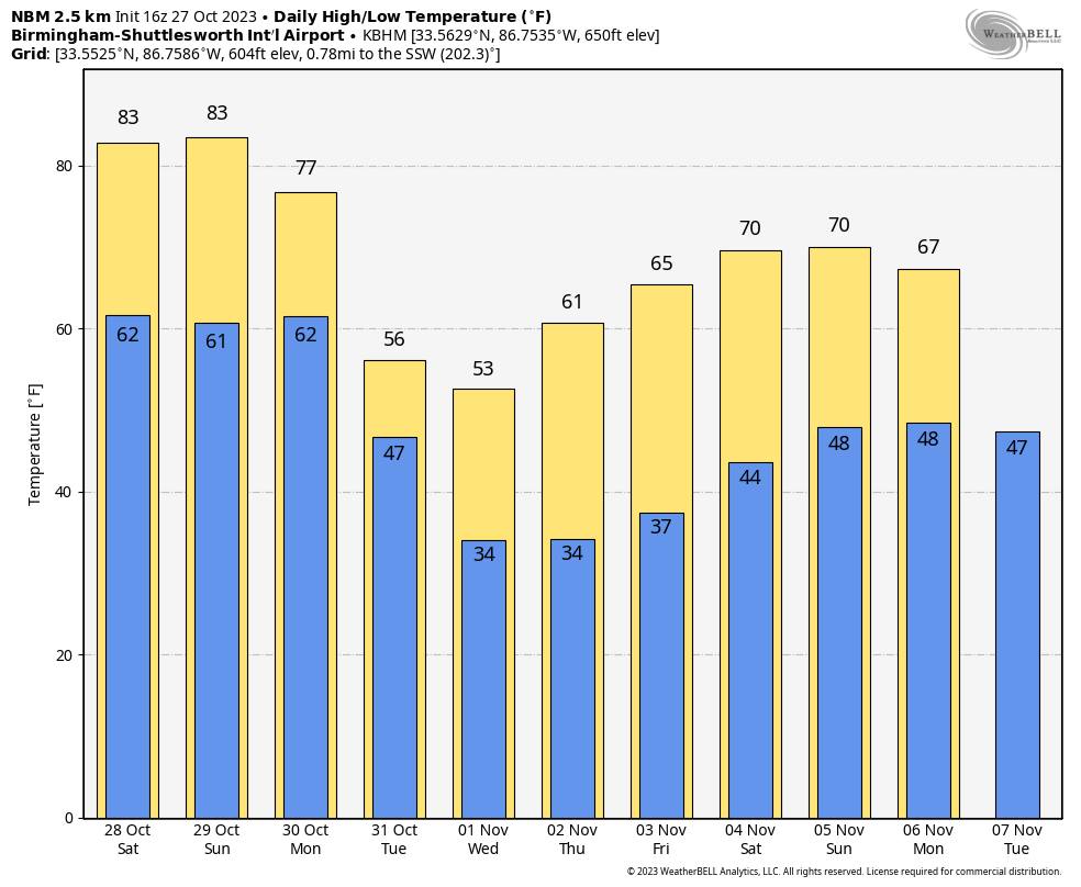
WARM, DRY WEEKEND AHEAD: An upper ridge will continue to keep opportunities for rain west and north of Alabama over the weekend. We expect partly sunny, warm days and fair, pleasant nights through Sunday. Highs will be between 80 and 85 degrees, with lows mostly in the 60s.
NEXT WEEK: The coldest air so far this season will roll into Alabama. The front will slowly move through the state Monday, setting up a big temperature contrast. By mid to late afternoon, the Tennessee Valley will likely be in the upper 40s, with mid 80s south of the front. New global model data suggests some light rain will be possible both Monday and Tuesday as the cold air arrives. Rain amounts should be less than a quarter-inch, however.
The weather will be dry Wednesday through Friday with very cool days and cold nights. Highs will be in the 50s over the northern half of the state Tuesday and Wednesday, with 60s to the south. Many north Alabama communities will likely see their first freeze of the season by Wednesday and Thursday mornings, with lows between 28 and 34 degrees. A warming trend begins Thursday afternoon.
FOOTBALL WEATHER: The sky will be clear for the high school games across Alabama tonight with temperatures falling from the mid 70s at kickoff into the upper 60s by the fourth quarter.
For Saturday’s Magic City Classic in Birmingham (Alabama State vs. Alabama A&M, 2:30 p.m. kickoff at Legion Field), the sky will be partly to mostly sunny with temperatures in the low to mid 80s. It will be a warm October afternoon.
Auburn hosts Mississippi State (2:30 p.m. kickoff) at Jordan Hare Stadium. Dry, warm weather is the story, with temperatures between 81 and 84 degrees for most of the game. The sky will be partly to mostly sunny.
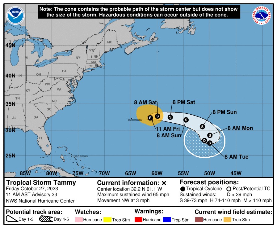
TROPICS: Tammy is a tropical storm again in the Atlantic, about 200 miles east of Bermuda. It will move slowly eastward, staying far from land through early next week.
A broad area of low pressure has formed over the southwestern Caribbean Sea. Environmental conditions could support some slow development of this system during the next several days while it moves generally northward. The National Hurricane Center gives this feature a 30% chance of development over the next seven days.
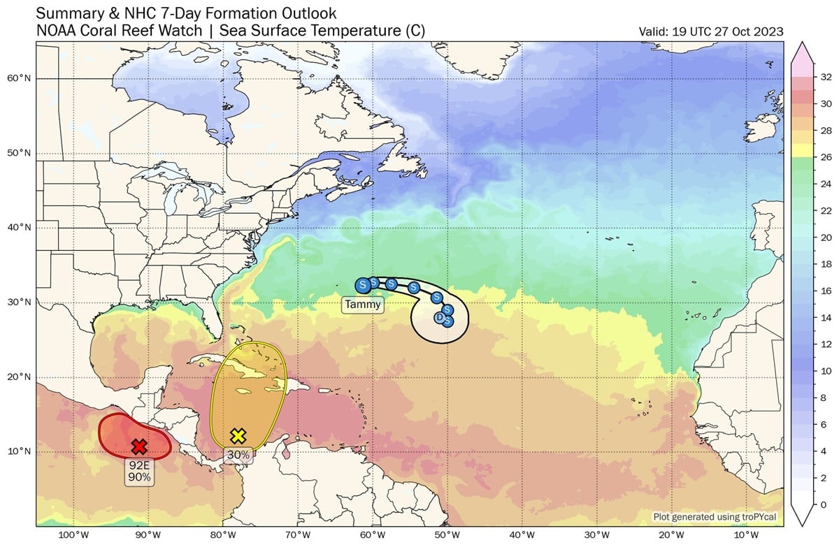
The rest of the Atlantic basin is quiet.
ON THIS DATE IN 1940: A late-season heat wave was underway across the Deep South thanks to a strong upper high. Birmingham’s high was 88 degrees, which still stands as the daily record high for Oct. 27.
ON THIS DATE IN 2006: An F1 tornado (waterspout) came ashore and caused significant damage on the west side of Apalachicola, Florida.
For more weather news and information from James Spann and his team, visit AlabamaWx.


