Scott Martin: Stormy Saturday ahead for Alabama

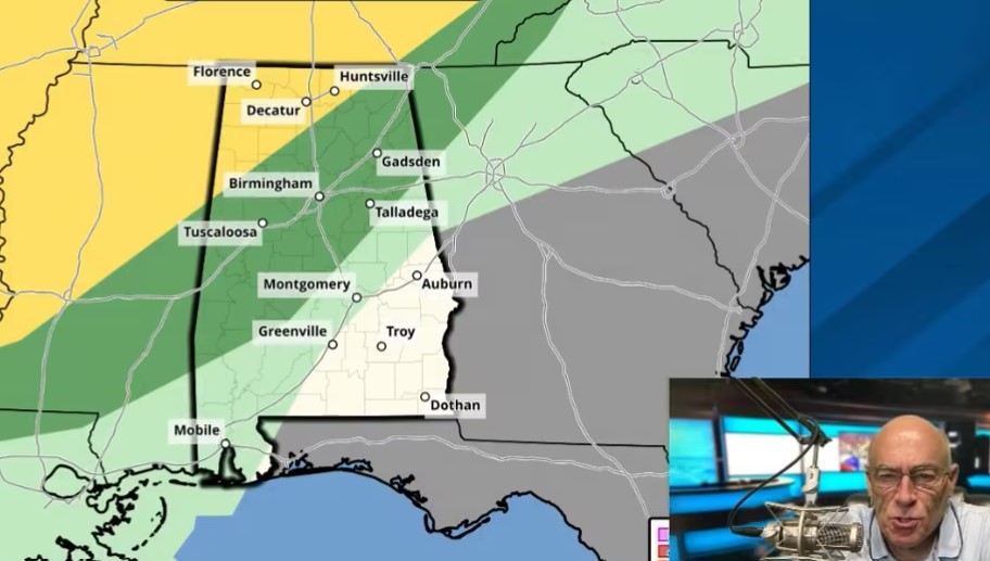
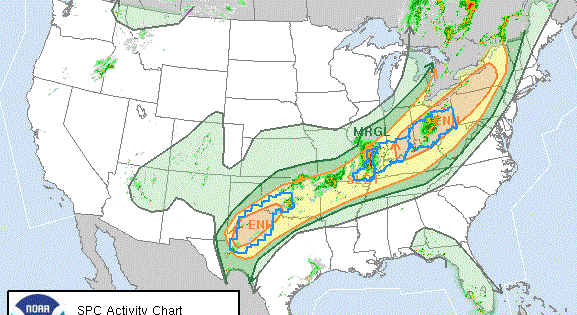
TODAY: A frontal boundary will gradually settle southward across the state. Scattered to widespread thunderstorms are expected to develop from late morning through the afternoon. Some storms may become strong, with the potential for wind gusts up to 60 mph and small hail. There will likely be breaks between rounds of activity, though the timing of those lulls remains uncertain. Highs will range from the upper 60s to lower 80s, depending on cloud cover and rainfall.
SUNDAY: The system exits the region, with an upper-level low passing to our north. Skies will be mostly cloudy, and while a few light showers may develop across far northern counties, most of the state will remain dry. Highs will range from the upper 60s to lower 80s.
MONDAY THROUGH FRIDAY: Look for a quiet start to the week with a mix of sun and clouds. Conditions stay mild and pleasant, with highs in the lower 70s to lower 80s. Tuesday will be partly sunny and warmer. A few isolated showers or storms may develop during the afternoon, but most areas will stay dry. Highs climb into the mid 70s to upper 80s. Wednesday will be partly sunny with a chance of scattered showers or storms, mainly later in the day. Highs will range from the mid 70s to mid 80s. Similar conditions continue Thursday, with a mix of sun and clouds and a few passing showers or storms possible. Highs remain in the mid 70s to mid 80s. On Friday, clouds will increase, and there will be another chance of scattered showers and storms. Highs will be in the mid 70s to lower 80s.
For more weather news and information from James Spann, Scott Martin and other members of the James Spann team, visit AlabamaWx.