James Spann: Alabama humidity levels to rise slowly over the weekend
James Spann has the Alabama forecast heading into the weekend from Alabama NewsCenter on Vimeo.
ANOTHER PLEASANT AUGUST MORNING: Dry air continues to cover Alabama this morning, and there is a little touch of fall in the air over the northern counties. Here are some temperatures just before sunrise:
- Russellville — 55
- Cullman — 57
- Courtland — 57
- Gadsden — 59
- Pell City — 59
- Scottsboro — 59
- Decatur — 59
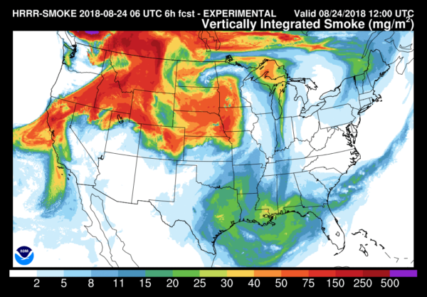
The sky will be partly to mostly sunny today with a high in the upper 80s for most communities; afternoon showers will be confined to the southeast part of Alabama, and even there they will be widely spaced. Smoke from the wildfires in the Northwest will be transported again today into parts of the state, making the sky pretty hazy.
FOOTBALL WEATHER: It will be a perfect night for high school football games tonight, mostly fair with temperatures falling through the 70s.
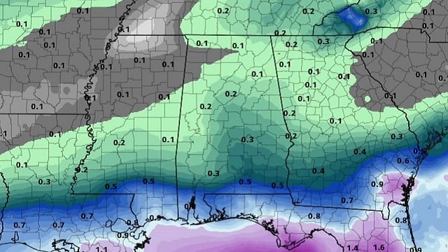
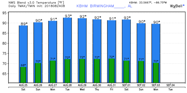
THE ALABAMA WEEKEND: The weather stays dry tomorrow for the northern half of the state. With a partly sunny sky the high will be in the upper 80s; there could be a few widely scattered afternoon showers or storms over south Alabama. Then, Sunday will be another partly sunny, warm day with the risk of brief, pop-up afternoon showers statewide in random places. Sunday’s high will be in the 87- to 90-degree range.
NEXT WEEK: An upper ridge begins to rebuild, so highs creep up into the low 90s daily. Days will be partly sunny with a few widely scattered, mostly afternoon and evening showers or storms possible — pretty routine late-summer weather.
TROPICS: Hurricane Lane continues to weaken just west of the Hawaiian Islands; it will become a category two storm later today. The main impact for Hawaii is rain and flooding. In the Atlantic, a well-organized wave is coming off the coast of Africa this morning, but dry air and cool water means no chance of development in the short term. The rest of the Atlantic basin remains very quiet.
ONE YEAR AGO TODAY: Hurricane Harvey was approaching the middle Texas coast; it would make landfall around 10 p.m. the following day (Friday, Aug. 25) between Port Aransas and Port O’Connor. Hurricane Harvey is tied with 2005’s Hurricane Katrina as the costliest tropical cyclone on record, inflicting $125 billion in damage, primarily from catastrophic flooding in the Houston area. It was the first major hurricane to make landfall in the United States since Wilma in 2005, ending a record 12-year span in which no hurricanes made landfall at the intensity of a major hurricane throughout the country. In a four-day period, many areas received more than 40 inches of rain as the system slowly meandered over eastern Texas and adjacent waters, causing unprecedented flooding.
BEACH FORECAST: Click here to see the AlabamaWx Beach Forecast Center page.
WEATHER BRAINS: You can listen to our weekly 90-minute netcast any time on the web, or on iTunes. This is the show all about weather featuring many familiar voices, including meteorologists at ABC 33/40.
CONNECT: You can find me on the major social networks:
Facebook
Twitter
Google Plus
Pinterest
Snapchat: spannwx
For more weather news and information from James Spann and his team, visit AlabamaWx.