James Spann: February warmth continues for Alabama through Thursday; cooler Friday
RECORD WARMTH: Here are some midafternoon observations across Alabama:
- Selma — 84
- Pell City — 84
- Montgomery — 83
- Tuscaloosa — 83 (ties the record for the date, set in 2018)
- Dothan — 83
- Muscle Shoals — 82 (new record high; the old record was 79, set in 1909)
- Auburn — 82
- Anniston — 81
- Birmingham — 81 (ties the record for the date, last set in 2018)
- Mobile — 81
- Gadsden — 79
- Huntsville — 79 (new record high; the old record was 77, set in 2018)
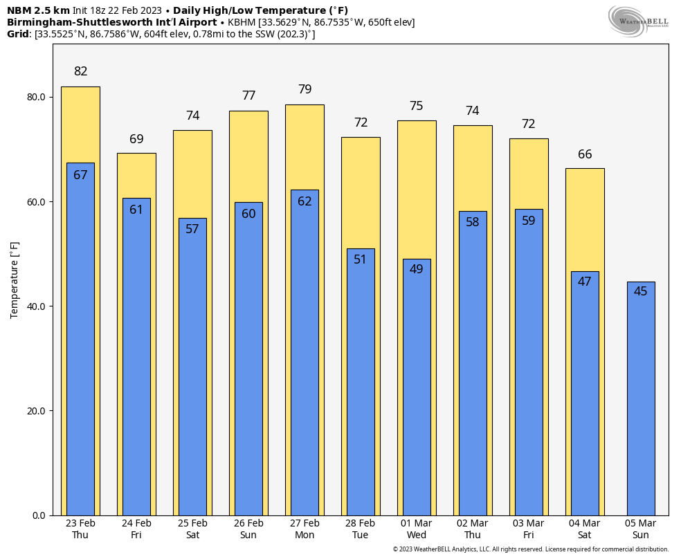
These are not official highs; we will have them later this afternoon. The average high for Birmingham today is 61. Strong south winds are gusting to 30-35 mph in spots; much of the state is under a wind advisory this afternoon.
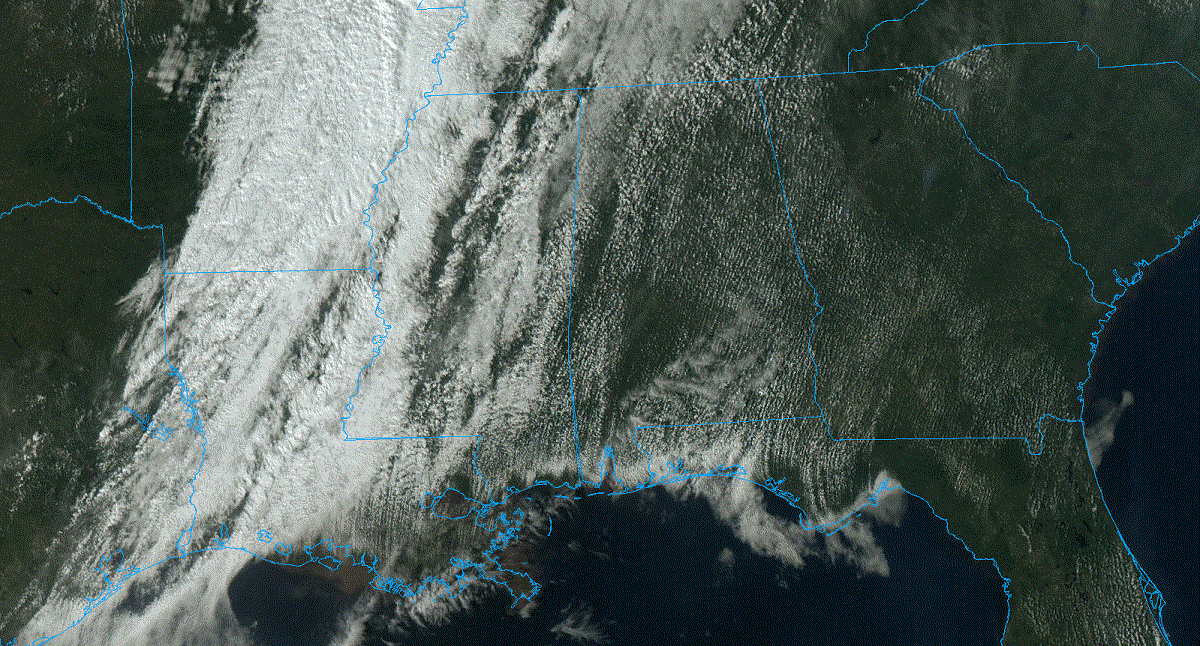
The sky is partly sunny, and we have no rain on radar. Clouds will increase tonight, and a few showers are possible across the northwest part of the state after midnight, but nothing too heavy or widespread.
Thursday will be another very warm day, with highs exceeding 80 in many areas; the pressure gradient will relax, so it won’t be as windy. A few spotty showers are possible, but many places will be dry.
FRIDAY AND THE WEEKEND: Cooler air dips into the state Friday; highs will range from the upper 50s over the Tennessee Valley to the 70s for south Alabama. Showers are possible Friday for the northern half of the state. For the weekend, highs will be in the 70s statewide. While south Alabama will remain dry, a few scattered showers are possible Saturday and Sunday to the north — again, nothing too widespread or heavy.
NEXT WEEK: A cold front will bring a chance of showers and possibly a thunderstorm Monday, but for now severe storms are not expected thanks to the upper ridge and limited instability. Dry weather is likely Tuesday through Thursday, followed by a chance of rain and storms Friday. Highs through the week will be mostly in the 70s.
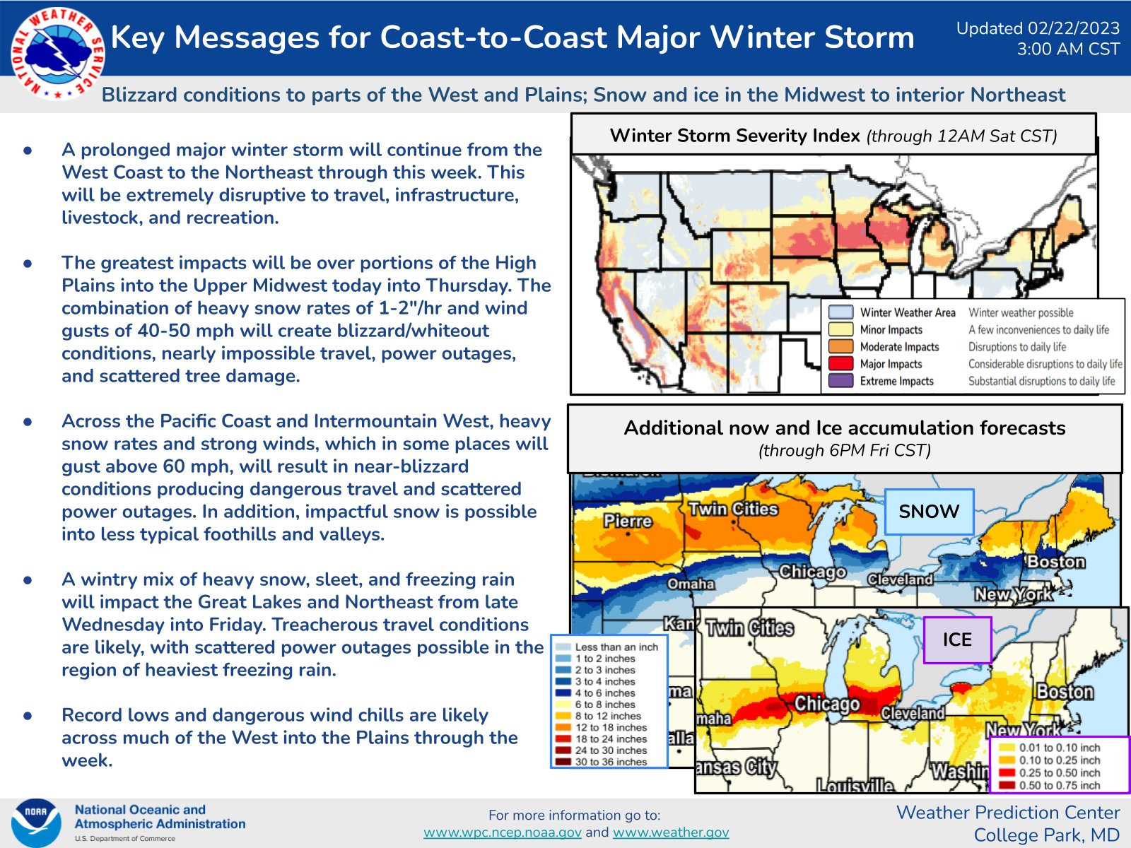
TO THE NORTH AND WEST: A major winter storm will unfold over the western and northern U.S. through the next few days. Impacts will be extreme for some locations with significant snow, blizzard conditions, icing and record cold temperatures possible.
ON THIS DATE IN 1998: Seven tornadoes struck east-central Florida late on Feb. 22 and early Feb. 23. Three of the tornadoes were rated F3 on the Fujita scale. Twenty-four people were killed in Kissimmee alone. A total of 42 people were killed and 265 injured, and the damage was $106 million.
BEACH FORECAST: Click here to see the AlabamaWx Beach Forecast Center page.
For more weather news and information from James Spann and his team, visit AlabamaWx.


