James Spann: Alabama gets colder Wednesday, with rain at times
PLEASANT AFTERNOON: Temperatures are mostly in the low 60s this afternoon with filtered sunshine through mid- and high-level clouds, 15,000-25,000 feet off the ground. Clouds will increase tonight ahead of an upper trough to the west.
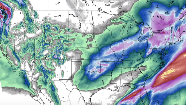
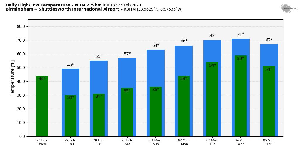
Wednesday will be cloudy, breezy and colder, with a few periods of rain thanks to a cold front passing through the state. Rain amounts should be one-quarter inch or less, and the high will be in the 49- to 52-degree range. The average high for Birmingham on Feb. 26 is 62. As colder air continues to feed into the state, high-resolution models continue to show potential for a few light snow flurries over north Alabama Wednesday night, but moisture will be very limited and there won’t be any impact.
THURSDAY/FRIDAY: Thursday will be a sunny day with a cold morning. After a low in the upper 20s, look for a high between 47 and 50 degrees. For most of the state, Friday will be dry with a decent amount of sun, but a disturbance riding down the back side of an upper trough near the East Coast will bring potential for a little light rain to the northeast corner of the state late in the day. A few snowflakes are possible Friday night in that same spot, but again precipitation amounts will be light and no impact is expected.
THE ALABAMA WEEKEND: The weekend will be dry; Saturday will feature a good supply of sunshine with a high in the upper 50s after starting the day around the freezing mark. We are forecasting a partly to mostly sunny sky Sunday with a high in the mid 60s.
NEXT WEEK: Moisture levels will rise, and a few scattered showers are possible Monday and Tuesday. Afternoons will be mild; the high will be in the mid 60s Monday, followed by low 70s Tuesday. Rain and thunderstorms are likely statewide Wednesday; it remains to be seen whether severe storms will be an issue.
RAIN UPDATE: Birmingham’s official rain total for February so far is 13.24 inches. That makes 2020 the third-wettest February on record, behind February 1961 (17.67 inches) and February 1903 (15.86 inches). Current rain projections for the next seven days suggest February 2020 will most likely stay in third place.
ON THIS DATE IN 1934: An outbreak of six tornadoes killed 19 in Mississippi, Alabama and Georgia. Hardest hit was Bowden, Georgia, and Shady Grove, Alabama. One home in Lauderdale County, Mississippi, was picked up, thrown 400 feet and blown to bits. Six family members were killed in the house.
ON THIS DATE IN 2015: Many Alabamians experienced one of the largest snow storms on record as more than 12 inches of snow was unofficially measured along the Highway 278 corridor in Marion County. In addition, much of the northern two-thirds of the state saw snow during the afternoon and evening, with totals of 1-2 inches near Interstate 20 increasing to 5-12 inches farther north to the Tennessee state line. The highest unofficial measurement came from Guin, Alabama, with 12.7 inches. Most of central Alabama was disappointed as only rain fell.
BEACH FORECAST: Click here to see the AlabamaWx Beach Forecast Center page.
WEATHER BRAINS: You can listen to our weekly 90-minute show any time on your favorite podcast app. This is the show all about weather featuring many familiar voices, including the meteorologists at ABC 33/40.
CONNECT: You can find me on the major social networks:
Facebook
Twitter
Instagram
Pinterest
Snapchat: spannwx
For more weather news and information from James Spann and his team, visit AlabamaWx.com.